Project Name: ALEWIFE QUADRANGLE LIVING WITH WATER
Location: CAMBRIDGE, MA USA
Organization: Urban Land Institute
Landscape Architect: Jessica Leete
Year Designed: 2014
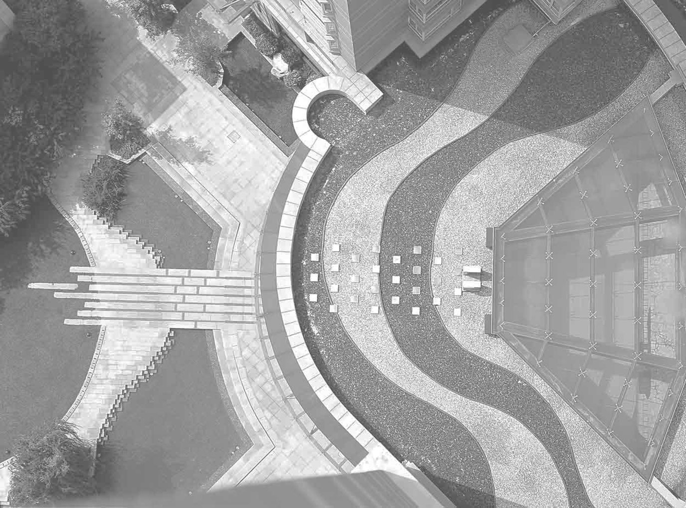
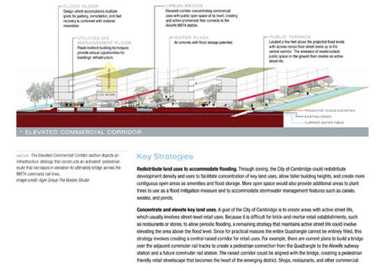
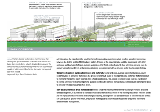
The Alewife Quadrangle is a 130 acre area in the western part of Cambridge that historically has been the location of low-rise, light industrial and commercial activities. Following the 2006 Concord-Alewife Planning Study and subsequent rezoning, the area has started to see new housing developments, but there is significant potential for additional new development and redevelopment. While most of the Quadrangle area is currently in the 500-year floodplain, the prospect of more frequent episodes of intense precipitation and the possibility of Alewife Brook backup up from storm surges affecting the Mystic River presents challenges. Yet, there is much value to the community to have an area for the types of uses that have recently located there. The key question for this session was: if the Concord-Alewife Plan were to be issued today with climate change factored in, how might Cambridge approach planning the Quadrangle area in terms of zoning, urban design guidelines, and non-regulatory or behavioral change methods?
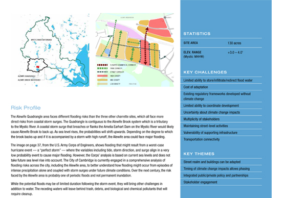
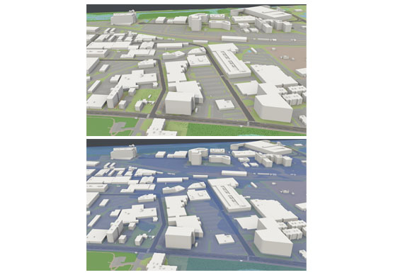
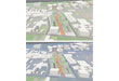
The Alewife Quadrangle area faces different flooding risks than the three other sites in the charrette, which all face more direct risks from coastal storm surges. The Alewife area is contiguous to the Alewife Brook system which is a tributary to the Mystic River. A coastal storm surge that breaches or flanks the Amelia Earhart Dam on the Mystic River would likely cause Alewife Brook to back up. As sea level rises, the probabilities will shift upwards. Depending on the degree to which the brook backs up and if it is accompanied by a high runoff event, the Alewife area could face major flooding.
The image below from the U.S. Army Corps of Engineers shows flooding that might result from a worst-case hurricane event – a “perfect storm” – where the variables including tide, storm direction, and surge align in a very low probability event to cause major flooding. However, the Corps’ analysis is based on current sea levels and does not take future sea level rise into account. The City is currently engaged in a comprehensive analysis of flooding risks across the city, including the Alewife area, to better understand how flooding might occur from episodes of intense precipitation alone and coupled with storm surges under future climate conditions. Over the next century, the risk faced by the Alewife area is probably one of periodic floods and not permanent inundation.
 |
 |
 |
||
 |
 |
 |
||